Hiking the British mountains and hills
This is a list of our walks in everything hilly in the UK (so this basically qualifies as Mountaineering).
The spots to explore are mainly:
- The Berwin range, in Wales (the closest)
- Snowdonia, in Wales (also close and more scenic, we started there in April (2017).
- The peak district.
- The black mountains (south Wales).
- The lake district.
- Cheviot Hills.
- Highlands, in Scotland.
- Irish mountains (MacGillycuddy's Reeks, Mourne & Sperring mountains).
Itineraries
Llyn Idwal
On 15 April (2017), with Camilo, as part of our Easter trip to Wales (April 2017).
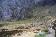
Llyn Idwal is a small lake in the Pont Pen-y-benglog area.
-
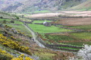 The Pont Pen-y-benglog area.
 -
 In the Snowdonia national park.
 -
 With paysages of outstanding beauty.
 -
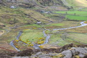
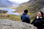
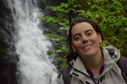
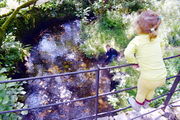
 The Llyn Idwal lake.
 -
 You can walk around following a well delineated path.
 -
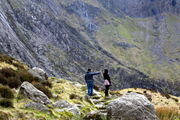
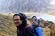
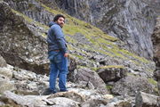
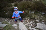
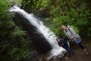
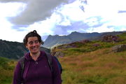
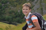
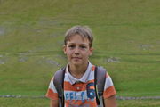
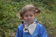
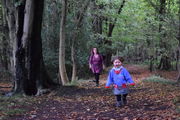
 Elena and Camilo ready to make the loop.
 -
 Each sight is fantastic.
 -
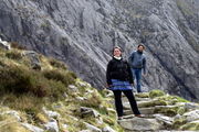
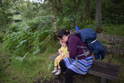
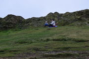
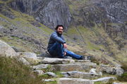 Taking a rest.
 -
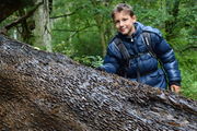
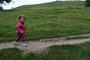
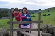
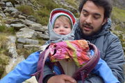 Julia stepping down from my back.
 -
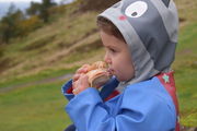
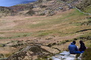 Picnic with a view.
 -
 Back on the trail.
 -
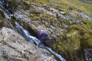
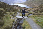
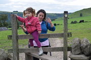
 A more difficult bit to cross.
 -
 Julia ready to keep going.
 -
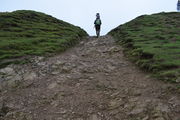
 The highest point of our itinerary.
 -
 A moment's reflection at our local top.
 -
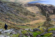
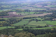
 The lake from above.
 -
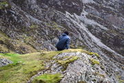
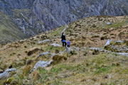
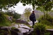
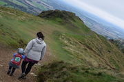
 Looking for the way down.
 -
 Found it!
 -
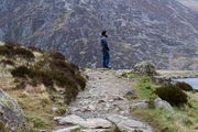
 Back to the easy trail.
 -
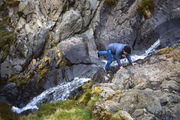
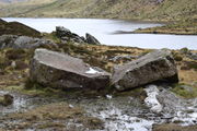 Rocks snapped by water like fingersticks.
 -
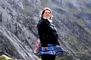
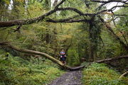
 Julia on her own.
 -
 With difficulties kindly adapted to her by the moutain.
 -
 But mummy is never very far.
 -
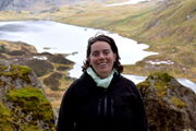
 Last look at the lake.


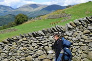
Our first lakes of the Lake district and the Cathedral Cavern
On 12 August (2017), with Georges who was visiting us and UK. This walk brought us round the Tom Ghyll waterfalls, the Tarn Hows lake, the mind-blowing Cathedral Cavern, some Cumbrian quarries and the Yew Tree Tarn lake.

-
 Tom Ghyll waterfalls.
 -
 At the beginning of the tour.
 -
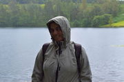
 Arriving at the lake: Tarn Hows.
 -
 It was still raining profusely.
 -
 One of the treasure trees.
 -
 Weather got sunnier and we could picnic here.
 -
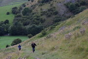
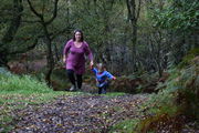
 Back on the track.
 -
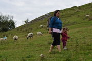
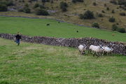
 Lambs happily and freely grazing.
 -
 Beautiful stone wall.
 -
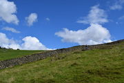 Extending over infinities.
 -
 Good spirits.
 -
 Escaping.
 -
 On the bridge.
 -
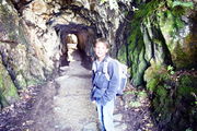 A tunnel in the quarries.
 -
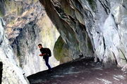
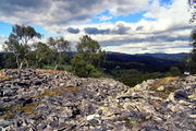
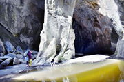 The Cathedral Cavern, the highlight of the walk.
 -
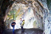
 A pillar that seems to hold the mountain.
 -
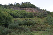
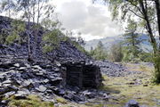 The quarries.
 -
 A spot discovered by Georges.
 -
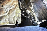
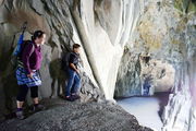 Literally a balcony on the Cathedral Cavern.
 -
 Probably one of the big sights of England.
 -
 Back to the quarry.
 -
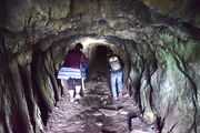 In another tunnel.
 -
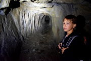 It is not clear where this one is going.
 -
 Back on our track, to close the loop.
 -
 Tiredness as the day comes to its end.
 -
 Last pause on the Yew Tree Tarn lake.
 -
 Georges chasing lambs as we wait for the girls.


Thorpe Cloud

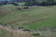
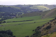
On 13 August (2017). On our way back from the Lake district, as this was a long way to Wolverhampton, we stopped at the Peak district. Although we camped in the evening, we had time for a delightful walk to the Thorpe Cloud. Not only has the mountain a fantastic shape, the walk (we parked in the nearby Ilam rather that at the overpriced Dovedale car park) through the fields with lambs running round and crossing the Dovedale stepping stones was big fun. The only negative point of the day was that we did not find any place to eat and ran out of gas in our tent, hence this was a frugal last day after much walking.
-
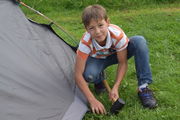 Finishing to install our tent.
 -
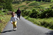
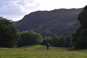
 From Ilam to the Thorpe Cloud.
 -
 We met many lambs on the way.
 -
 From one field to the next.
 -
 Getting there...
 -
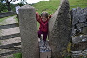
 Another stile.
 -
 Julia seemed to have done that all her life.
 -
 Georges chasing lambs again.
 -
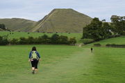
 Ascending the Thorpe Cloud.
 -
 A steep slope. Lambs are quickly receding into dots.
 -
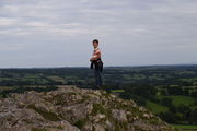 Reached the top!
 -
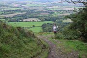
 The view from there.
 -
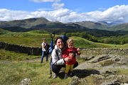
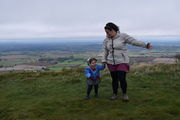
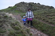
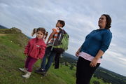 Everybody there.
 -
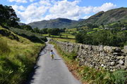
 Pausing with the river Dove.
 -
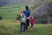 Georges pointing at a hot balloon.
 -
 View on the other side.
 -
 Georges in the peak's greenery.
 -
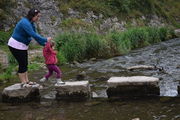 The stepping stones over the Dove.


Round the Wrekin
The Wrekin is a mythic hill of Shropshire, although not an impressive one to the eye; here you see Julia and Elena in front of it:

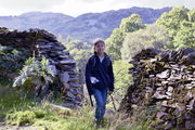
It is nevertheless a prominent, well-known and cherished local landmark, if not a symbol of Shropshire (at least to motorists who recognize it from the nearby motorway). A famous local expression (that locals would tell me when hearing of our excursion) is going round the Wrekin to mean, taking endless detours. There is also an adorable legend about a giant (Gwendol Wrekin ap Shenkin ap Mynyddmawr) discouraged in its plot to smother Shrewsbury by a clever cobbler, resulting in the material he had collected to be dumped at its present location. The otherwise flat surrounding indeed makes this vestige of a foiled revenge stand out, even though it is a mere 407m above the plain. It is the extension of Shropshire AONB into Telford and is also of much geological significance for its little companion, the Ercall which stands by its side. You can access both, starting with the Ercall, from Wellington's train station, which is how we approached this legend. The walks through the nearby woods are enchanting. It was a very windy day, so much so that we could not stay too long without taking cover. It is said to be extremely popular although we found few other people and even found ourselves alone treading it at some point.
-
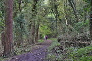
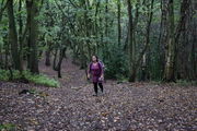 The woodland of the Ercall.
 -
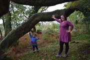
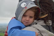
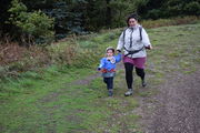
 Julia did some walking but still spent much of the walk somewhere on top of me.
 -
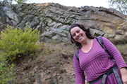 Elena with the Ercall rocks.
 -
 With a better view. The expert eye can discern a clear geological fault here. If you have time you can find sediments around.
 -
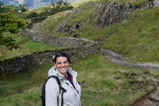
 Pausing for the photo, looking natural.
 -
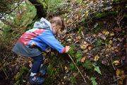
 A hiker in the making.
 -
 Julia increasingly covers parts of our walks on her own.
 -
 Getting near the top of the Wrekin.
 -
 Here we are.
 -
 The blues of achievement.
 -
 It was so windy, we had to take cover behind these rocks.
 -
 which were good enough shelter for a snack.
 -
 with beautiful views of Shropshire.
 -
 These views.
 -
 Time to keep going round the Wrekin.
 -
 Little Julia being informed of Gwendol Wrekin ap Shenkin ap Mynyddmawr.
 -
 Running with the wind.
 -
 A few meters from the top, and the wind had completely gone... it was as if the Wrekin wanted to simply blow us off.
 -
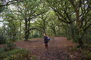
 Back in the woods.
 -
 Almost there.
 -
 Back to our starting point, on the other side.


Clent Hills
On 8 February (2020), at the occasion of our 6th campervanning trip.

A 7.7km circular walk in 3h40 with a visit of Clent's church (and a fail attempt to eat at the Vine Inn, though we would achieve that on the next day). It is the most popular hillwalking site and even non-paying attraction in the Worcestershire area [1] and was indeed quite busy when we visited, despite storm Dennis passing by. The Clent Hills are named after the village Clent that sits in between the hills, itself formerly Klinter (cliff). The church was very pretty, with a glass cross to commemorate apparently a representation of Jesus Christ superstar there. The Clent Hills are also the placed where a Saint (Kenelm) was murdered.
-
 On the top of Walton hill.
 -
 The suburbs of Birmingham in sight (probably Halesowen).
 -
 Closer, a British farm (high Hartcourt farm), between Walton & Clent hills.
 -

-
 According to the national trust, it is now thought this ditch is a hollow way, a well worn track, which passed alongside a long disappeared cattle inclosure.
 -
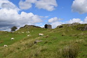
 Maybe the most iconic view from the Clent hills.
 -
 Elena and Julia posing by.
 -
 With Grelot.
 -
 Getting down from the Walton towards the "real" Clent Hills, with the Vine Inn on the right.
 -
 Running down the hills.
 -

-
 Clent's church, Saint Leonard.
 -
 Elena in the church garden.
 -
 Julia picking up flowers.
 -
 Peaceful atmosphere.
 -
 Inside, with a beautiful medieval chancel roof .
 -
 A nearby Clent brick-house.
 -
 Back to the hills.
 -
 Now in the authentic Clent ones.
 -
 With again benches awaiting.
 -
 The Four stones.


Caer Caradoc
On 1 March (2020), as the highlight of our 7th campervan trip to the Shropshire hills (Caer Caradoc)

We wanted to have a go at the Shropshire hills and settled for one of the flanks of Church Stretton. Caer Caradoc looked shorter and easier than the Long Mynd, and since Elena was 7th month pregnant, we opted for that option. We could only make a late start as the weather was uncertain till the late morning, with a few showers, although predicted as cloudy (but not rainy) for the day. So we spent this time in Church Stretton instead. When we finally got started, we did not plan to get till Caer Caradoc since time was amputated from the morning and the weather was still unclear as to its afternoon intentions. Already on the first summit, on the flank of the Hope Bowdler Hill, it got very windy and showering violently. As quickly as it started, it stopped and we enjoyed a quiet and sunny talk until it turned all black again, with the hills in front getting absorbed in darkness, first from the sun gone and then disappearing in the fog. It hailed profusely for a few minutes, which was really a wondrous and enchanting spectacle. After that, it was all sun for the rest of the day, although the ground got quite wet in spaces. This was the first walk maybe where Julia was leading for much of the walk (at least in its first phase) and also expressed genuine and exalted admiration at the scenery. Down the first hill and towards Caer Caradoc, Julia fell on the muddy, soaked floor, and we had to change her. The ascension to Caer Caradoc was a bit more difficult than expected and Julia and Elena sheltered by a rock while Fabrice completed to the top, enjoying the panoramic views and to get a glimpse of what was on the other side. More Shropshire. We got back but could not follow the main road which was not going in the right direction, so we cut through fields, very wet again, and we had to jump a gate to get back to the road. Fabrice closed the loop running to fetch back the van. A long hike (9.4km in 4h52), especially as Luz was almost part of it. Elena got, not precisely sick, but unwell in the night, though possibly as a result of the Greek food we got after in the pub of the village.

-
 Lambs scattered in the sky.
 -
 Starting the ascent.
 -
 Julia is by now an experienced hiker.
 -
 Elena was 7 months pregnant.
 -
 Darkness already looming on our first summit.
 -
 Julia taking the lead.
 -
 On this side, the sky is blue.
 -
 Waiting for maman.
 -
 Caer Caradoc from Hope Bowdler hill.
 -
 Met him on the way.
 -
 Company.
 -
 Caer Caradoc.
 -
 Hope Bowdler hill. It's easy when it's flat.
 -
 Although you still need a break once in a while.
 -
 Back on the road.
 -
 Gentle slope but a long way to go.
 -
 Caer Caradoc doesn't seem any closer.
 -
 Almost on our 3rd summit.
 -
 While mummy's still descending from the 2nd one.
 -
 Will Julia be there first?
 -
 Going up and down.
 -
 Dark clouds coming back.
 -
 This happened.
 -
 Winter fighting Spring.
 -
 And they're gone.
 -
 Carrying on, with uncertain weather.
 -
 Caer Caradoc closer than ever.
 -
 It's a steep descent before getting to its flank.
 -
 Now officially attacking Caer Caradoc.
 -
 Stairways to the top.
 -
 We walked all the hill in front, and now on Caer Caradoc.
 -
 On top (Fabrice alone).
 -
 Elena and Julia sheltered by this rock.
 -
 Too much light and colors to make good pictures.
 -
 Back together to close the loop.
 -
 The mountain opening a gate of rocks to say goodbye.
 -
 Rocks on the edge of Caer Caradoc.
 -
 Time to go back down.
 -
 Crossing through the fields. Extenuated.


Possible walks
Others that one could make from a train station (as we did for the Wrekin).
- Mam Tor and the Great Ridge from the Hope (Derbyshire) station.
- Stanage Edge from Hathersage station.
- Matlock Bath, High Tor and Heights of Abraham from Matlock Bath.
- Hathersage Moor and Padley Gorge from Grindleford.
Snowdonia:
Midlands:
Links
- https://www.walkingenglishman.com Great site with many well-documented walks.
| |||||||

| ||||||||||||||||
