Trip on the hwy1 (2012)
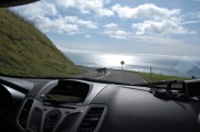
First week of February, we did a road trip on the Californian coast (in the wake of a SPIE conference in San Francisco). We drove along back and forth the mythic Highway 1 going down to Big Sur in the south and up to Mendocino in the north. It was a great experience with innumerable stops all along the way, exploring mainly the cliffs and beaches, but also surrounding mountains, forests and villages. In this page we record the most striking landmarks of this short expedition.
First day
<googlemap lat="37.278424" lon="-121.865845" type="terrain" zoom="8" width="730"> 37.826544, -122.422740, Alcatraz, 27 January (2012) 37.614198, -122.498006, Mori Point, 28 January (2012) 37.561050, -122.509623, McNee Ranch, 28 January (2012) 37.537402, -122.519496, point Montara light, 28 January (2012) 37.181487, -122.394413, Pigeon point lighthouse, 28 January (2012) 37.011437, -122.195225, Davenport, 28 January (2012) 36.992179, -122.170017, Panther beach, 28 January (2012) 36.959519, -122.038199, Santa Cruz, 28 January (2012) 36.587036,-121.90029, Padre Oaks motel in Monterey, 28 January (2012) </googlemap>
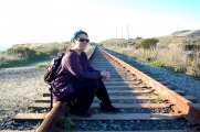
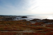
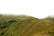
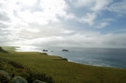
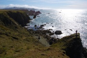
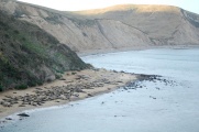
Mori Point
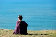
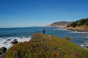
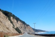
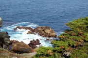
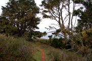
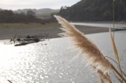
Our first stop on the way, so a moving first contact with the Californian coast. Whitish reeds scattered on greenly hilly grounds accompanied our walk to a prominent point dominating a typical Pacifica beach on the left and the protruding Mori Point on the right. We walked along the imposing cliffs, marvelling at the natural beauty but regretting the ugly cheap constructions miserably cluttered in these wild and gigantic surroundings.
-
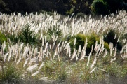 Californian reeds.
 -
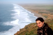
 The Coast.
 -
 Notice people in the distance!
 -
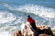
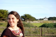
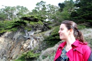
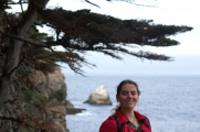
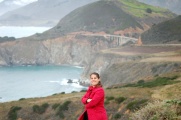
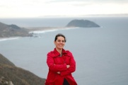
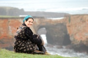
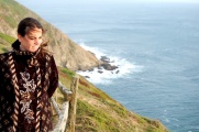
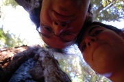
 and Elena too...
 -
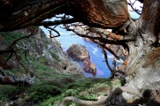
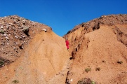 A corridor in the earth.
 -
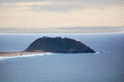
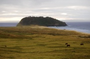
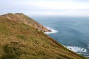
 An headland on the ocean.


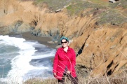
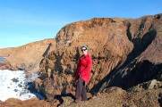
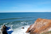
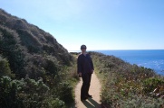
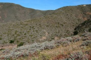
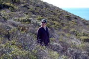
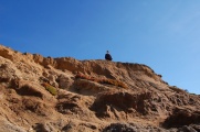
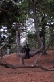
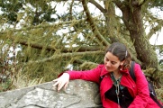
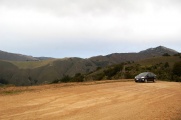
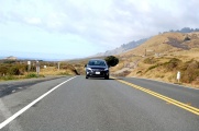
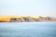
McNee Ranch
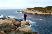
We stopped at the feet of a hill which dominated the coast from a short distance. We climbed it up and got a view of the typical hilly scenery of North California. Sadly mountains were in the way to San Francisco, otherwise providing the sort of view Gaspar de Portolá might have had when first sighting the bay.
-
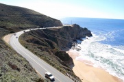 The hwy1,
 -
 and its pedestrian neighbour.
 -
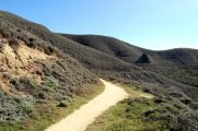
 Ascending the mountain.
 -
 View from the top.
 -
 On the way back,
 -
 through the local vegetation.


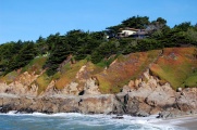
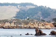
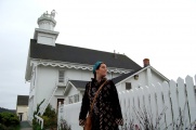
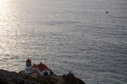
point Montara light
The point Montara light was another impromptu stop but of such stupendous beauty that we made it one of the major stay of our first day's itinerary. Cliffs were entirely covered with a colourful vegetation, making them a romantic background for prettier villas than the ugly buildings we had spotted previously. Rocks shattered by the ocean complemented the picture with wild, fresh and tumultuous smells and sounds. This scenic little spot looked a perfect location for a romantic or mystery movie.
-
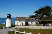 The Montara lighthouse.
 -
 The coastal point which hides behind,
 -
 with its cliff
 -
 and its rocks and ocean,
 -
 all surrounded by beautiful colours.


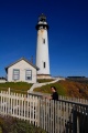
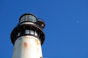
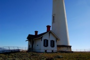
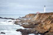
Pigeon point lighthouse
The Pigeon point lighthouse was the only stop for this day which we had scheduled from our guidebook and, ironically, the one that came last in order of favourites. In part, this was due to the affluence of tourists, absent from other spots. The lighthouse was a pretty one but only slightly more so than at point Montara, which had a superior scenery and atmosphere. A small museum was showing passers-by how the village was more beautiful before.
-
 The more famous Pigeon point lighthouse.
 -
 An archetype of the genre.
 -
 Also a renowned point to sight migrating whales.
 -
 We didn't see any in the sea but met with our first skull.
 -
 Last view was the best.


Davenport
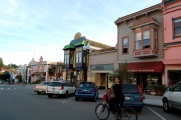
We wanted to stop for lunch in a typical village on the road, which turned out to be Davenport. We could hardly have made it more picturesque: the saloon with bikers, american families devouring huge hamburgers, coca-cola refills... The village itself was also full of this typical american atmosphere, but of the kind you're not prone to admire. The sort of sight which you feel the first of them might already have been one too many... in stark contrast with the coast, to which we thereafter consecrated most of our time, to the point of skipping lunch and making the shortest possible stops in inhabited areas. In fact, we realized we took no picture from Davenport itself (?!), although it was definitely one milestone on this first day and a cherished memory (but of the type which only makes mental pictures).
-
 Our best picture of Davenport might be getting away from it,
 -
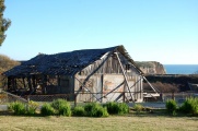 or this nice barn falling apart, almost not part of the village anymore.


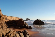
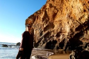
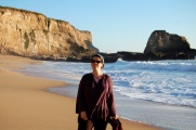
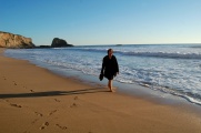
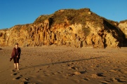
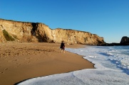
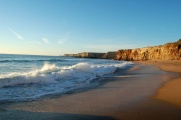
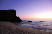
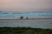
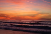
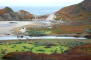
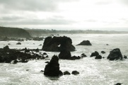
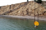
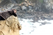
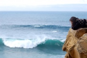
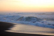
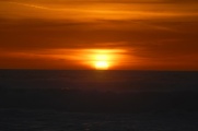
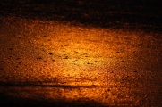
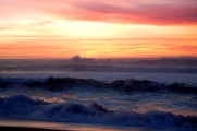
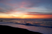
Panther beach
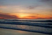
The Panther beach was the highlight of the day, as it combined one of the so-called "pocket beaches" of the Coast Dairies [1] and our first sunset on the pacific ocean. The beaches are enclosed within steep cliffs and interconnected by holes in the rocks. The sinking sun shining on that gave sharp orange tones dying into the pinkish as the ocean was smothering the light. An inexpressible experience.
-
 On our way to a pocket beach...
 -
 Once there.
 -
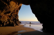 Beaches are connected to others through caves and passages in the rocks.
 -
 First contact with the ocean.
 -
-
 We stayed there a long time,
 -
 and could have stayed forever...
 -
 But then waves started to grow...
 -
-
 and the sun to set in.
 -
 The cliffs caught fire!
 -
 And the colours started to dance
 -
 a tango
 -
 with the sea...
 -
 making the sky purple jealous!


Second day
<googlemap lat="36.59844" lon="-121.90876" type="terrain" zoom="12" width="730"> 36.618781, -121.901761, Monterey bay aquarium, 29 January (2012) 36.637073, -121.935831, Ocean view & Sunset drive, 29 January (2012) 36.620944, -121.917552, Pacific Grove, 29 January (2012) 36.616116, -121.943752, Asilomar beach, 29 January (2012) 36.558297, -121.921408, Carmel Wayfarer Inn, 29 January (2012) </googlemap>
Monterey bay aquarium
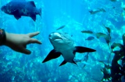
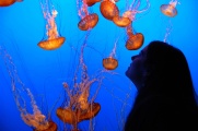
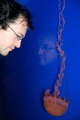
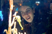
Worldwide famous, the aquarium of Monterey has a vast collection of oceanic fauna and flora, and one of its tank is supposedly the largest in the world. It is big enough so that a diver can hand-feed the sharks in there. Pinguins and puffins are of special interest, in particular the latter as you can contemplate how they swim: they literally fly underwater. The lobster tank has gigantic types. As they are extremely territorial, they restlessly chase each other in their small tank. The jellyfishes are another breathtaking attraction: you can admire their dance of light and motion, suspended in time and water. The one which literally glow light by phosphorescence provide one of the most fantastic natural show one can imagine. Among countless curiosities, we were particularly marked by jumping fishes (leaping blennies), spaceship-looking stationary molluscs aspiring hermit crabs, the formations of small-fishes producing macroscopic patterns in the big tank or the endless swim of sardines tricked in a circular motion, probably thinking they're crossing an ocean when they're just circling round a room of the old cannery. The scales of the collection is also mind boggling: you get in touch with various specimens from magnified microscopic plankton to giant tuna fishes and sea turtles (with their faithful escort post by their belly). The plethora of different breeds of seahorses gives a hint of the number of variations there can be in the animal kingdom... It was difficult to make pictures as the light was dim and most fishes are moving. Below we show shots which came out relatively neat, although they don't include some of the most striking sightings, including turtles, big sharks with their nasty looking expressions or the gigantic lobsters fighting each other.
-
 The Monterey bay aquarium.
 -
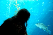 You get to marvel at a wealth of open-sea animals from a close distance.
 -
 So close you feel you could touch them. The most clever ones of them seem to feel like that too.
 -
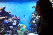 Exotic fishes are fun to take pictures of, and most of the Monterey collection, we had never seen before.
 -
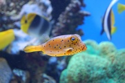 This one for instance was literally a cuboid.
 -
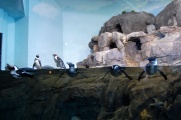 Birds, like puffins or, here, penguins, were the most interesting, but didn't make for the best pictures.
 -
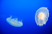 Jellyfishes were more photogenic.
 -
 Although our pictures don't make them justice.
 -
 They were fascinating to see at such a close distance.
 -
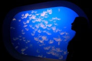 Jellyfishes were Elena's favorite. Fabrice preferred the sharks, but they were too fast to make good picture in the dim, bluish lights of the aquariums.
 -
 Seahorses were in plentiful variety (of sizes, colours, shapes...) They are special in almost all aspects you can imagine.
 -
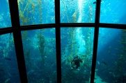 Some tanks were so big, you would hardly notice one of the big fishes was actually a diver feeding them.


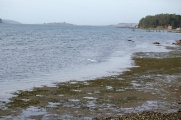
Ocean view boulevard, Sunset drive & Pacific Grove
A famous walk of Monterey is along the beach, separating the fancy expensive villas from the ocean which meets the land alternatively in rocks, in fine sand and in this greeny-reddish—now familiar—vegetation, mixing them in all the possible combinations. We did this by bike as the walk was too long on our schedule, but we definitely could get a taste of what it should be to leave there and go for this relaxing and mind-opening walk every evening. On our way back we biked through the city, in particular Pacific Grove was a nice ride with an air of authenticity breathing through its woody houses and picturesquely attired villagers.
-
 The famous Monterey walk.
 -
 A lighthouse in the distance.
 -
 The sandy beach fighting off vegetation.
 -
 The nice mansions on the other side.
 -
 The colourful American wood buildings.
 -


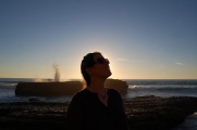
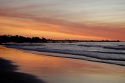
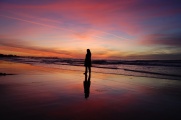
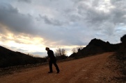
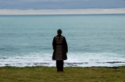
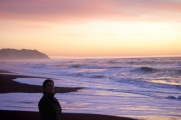
Sunset on Asilomar beach
We stopped on this beach which we had previously visited with the bikes to see the sunset, and were stunningly surprised by the show of colours that was so different than the one of the previous day. We felt as if we never had seen a sunset before. Although the beach was rather innocent looking by day—with a nice cover of white sand fading into wild vegetation, but lacking cliffs or imposing rock formations—it literally transformed as the sun dived into the sea. The sandy ground became a perfect mirror and the skyline a furnace that burnt into the night through violent tones of dark reds and blues. We made hundreds of pictures of us jumping and running through these surreal lights. It was only the second sunset of our trip and it impressed us even more than the one of just a day before, which already counted among the most beautiful one we had ever seen.
-
 The last surfers leaving.
 -
 The sunset colours starting.
 -
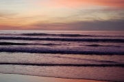 Waves of blue sent by a pinking sky.
 -
 The beach itself,
 -
 as a perfect mirror,
 -
 of the sky.


Third day
<googlemap lat="36.402494" lon="-121.758728" type="terrain" zoom="10" width="730"> 36.542669, -121.919743, Carmel mission, 30 January (2012) 36.522077, -121.952390, Point Lobos, 30 January (2012) 36.371556, -121.902072, Bixby bridge, 30 January (2012) 36.401128, -121.911492, Rocky point, 30 January (2012) 36.356881, -121.906650, Hurricane point, 30 January (2012) 36.309676, -121.886101, view of Point Sur, 30 January (2012) 36.270396, -121.808146, Southest point of our hwy1 trip 30 January (2012) 36.324773, -121.859238, Old coast road, 30 January (2012) </googlemap>
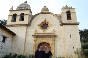
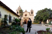
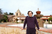
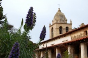
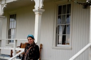
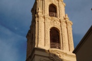
Carmel mission
The Carmel mission was a point on our itinerary on which we planned to stop because of its historical significance but that we foresaw would be a short stay as we are familiar with historical buildings of all sorts, from our European upbringing. The mission, indeed familiar if it had been on the old contient, had nevertheless a real grip on us, maybe because as and old stone building it departed neatly from the Victorian wood buildings, giving back to California a touch of dignified and distinguished cultural heritage. We thus ended up spending most of the morning, happily strolling slowly through the refreshingly familiar patios and corridors of the majestuous building, vibrant with its distinctively Spanish touch.
-
 Carmel mission
 -
 and its forecourt
 -
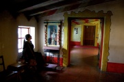 and interiors
 -
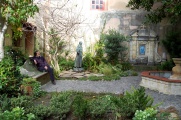 and its patio
 -
 and its backyard.
 -
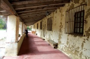 Its corridors.
 -
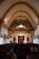 The church.
 -
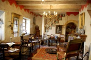 A room preserved from time.
 -
 A style preserved from fashion.


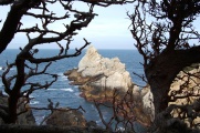
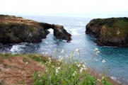
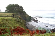
Point Lobos
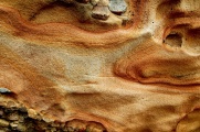
Point Lobos was one of the highlights of our entire trip. It is one of the most beautiful places of the word that we have ever visited. Strangely, or maybe expectedly, it is also the one to which our pictures make the biggest outrage: we do not find in our shots the particularity, the magic, the beauty of the place. Possibly this is because of the particular condition, cloudy and misty, with light diffusing a lot on every particle it found on its way. Greatly responsible for the unique feel of the place, we think, was foremost the lichen—the lace lichen type in particular—which hanged from the trees like cobwebs. Their colour between the dark yellowish, the glowing grey and the blueish green painted an already outstanding décor with the fantasy of a fictitious scenery. To describe the place concisely, we would say this is the magical woods of the fairy tales, some place where you expect the trees to jump alive on your way and embrace you with their twigs. The meeting of the ocean with the rocks found there a consecration with the magical forest grown on them. Other areas of Point Lobos are, on the contrary, naked rocks shaped over the millennia to resemble the waves of the sea, capturing other tiny rocks in the process. A sort of tempest in stop motion, with the real turmoil of the ocean in background.
-
 Point Lobos.
 -
 One of the most beautiful places we've ever been to.
 -
 The meeting point of beautiful trees,
 -
 beautiful sea,
 -
 beautiful coast,
 -
 beautiful rocks
 -
 and beautiful scenery.
 -
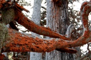 Bringing a lot to this already outstanding landscape is a pervasive lichen, here a brownish one (the colour comes from carotene).
 -
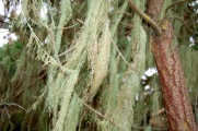 Lace lichen is however the most impressive, both for its colour and its eerie texture.
 -
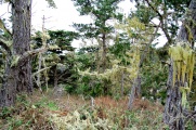 This gives fairy-tale décors like this one.
 -
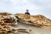 Everything seems to be always full of surprises, from strange rock formations...
 -
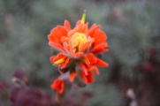 to colourful vegetation
 -
 funny trees,
 -
 wildlife of all sorts,
 -
 and shining shells...
 -
 A whale observation point... The only whale we saw was on the bench itself.
 -
 A last look at this wonderful place,
 -
 and back on the trail again.


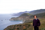
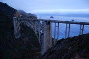
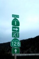
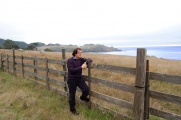
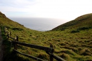
Various stops on the road
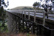
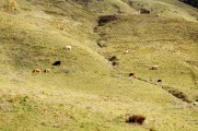
We then continued south and stopped in many locations, the most important one being the Bixby bridge, the Rocky point, the Hurricane point and at the entry of Point Sur, which was already closed when we passed by. The latter is an original sighting as it puts like a point in the ocean a steep bumpy hill crowned with a village and its lighthouse, separated from the rest of the land by a wide and gently flat corridor of sand. With cows scattered on a bright green grass in the first plane, it gave the whole a nice touch of the wide wild west.
-
 One of our frequent stop on the side of the road...
 -
 For some reason we felt that the Bixby bridge was a very inspiring background.
 -
 in the fog and in its soft palette.
 -
 Here is a wonderful view of Point Sur.
 -
 A close up.
 -
 And again when passing by.
 -
 Just every stop would seem to be magical.
 -
 with mystery and great poetic content
 -
 or just surrealism.


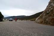
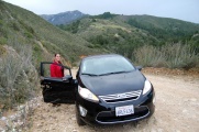
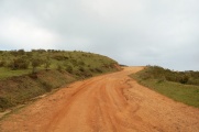
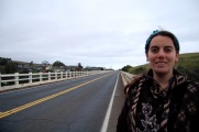
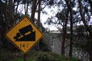
Old coast road
On our way back, we dared to take the old coast road, a dust-road detour through the mountains which was the historical route before the Bixby bridge, to which it provides, by the way, the best views. Our car wasn't really the most suitable to attack the steep and sometimes narrow (some other times, ridiculously wide) road, which we had to share on a couple of times with huge 4x4. The 12 miles road at peak speed of 10mph however gave us some of the most unique views of the coast, and the drive—in a cloud of brown dust—was fun, partly because it was a bit questionable as to whether we shall be able to make it.
-
 We took the old coast road on our way back.
 -
 This is a 12 miles long-cut in the mountains, on a wide dirt road.
 -
 Although the road looks okay on the picture, it was a bit tough to manoeuver.
 -
 Here Fabrice is removing a rock off the way.
 -
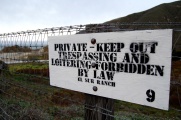 Also in this remote and almost abandonned road we found plenty of the typical American threats of no-trespassing (this one is not from the old coast road itself but they're all similar).
 -
 With relief, we made it through, and got rewarding views of Bixby bridge as a welcome back on the hwy 1.


Fourth day
<googlemap lat="38.942321" lon="-123.409424" zoom="8" width="730" type="terrain"> 38.416754, -122.714359, Country Inn in Santa Rosa, 30 January (2012) 38.392090, -122.878570, Bill's farm basket, 31 January (2012) 38.346105, -122.971917, Bodega, 31 January (2012) 38.356142, -123.067877, Coleman beach, 31 January (2012) 38.371708, -123.075532, Viewpoints on an arched rock, 31 January (2012) 38.914444, -123.710958, Arena Cove, 31 January (2012) 38.954383, -123.740268, Arena lighthouse, 31 January (2012) 39.297496, -123.791698, van Damme forest, 31 January (2012) 39.306316, -123.798518, Mendocino, 31 January (2012) 39.226661, -123.768761, Albion river bridge, 31 January (2012) 38.767724, -123.530614, Surf motel, Gualala, 31 January (2012) </googlemap>
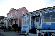
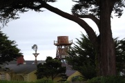
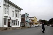
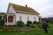
Bodega
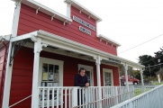
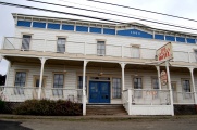
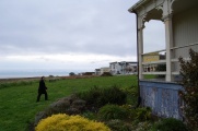
We stopped in this little village because a house and its neighbour church caught our attention. We made a couple of pictures and headed to the centre of the village, which was less interesting but still had a nice touch of a little place which kept much of its character from a time long gone. One of the house was featuring Hitchcock a lot but we didn't pay much attention to that, yet. In the postmail office—also notable for its authentic cachet—where we went to buy stamps for our postcards, we asked to the talkative postmaster (who didn't have stamps) confirmation of the name of the place for our records, to which he confirmed this was Bodega indeed, the place where Hitchcock filmed "The Birds", he added. The house in front was in fact partly of a museum/souvenir shop of items related to this movie. We learned that the house where we parked was in fact the one famously featured as the one which the children are running from during a savage attack, of embarrassing poor special effects by the standards of today.
-
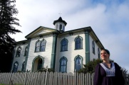 A famous house for the cinephile.
 -
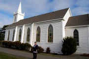 The church nearby.
 -
 Downhill are typical colourful wood houses.
 -
 The post.
 -
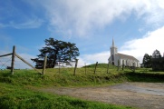 The church as seen from the village.
 -
 The claim to fame of this place.


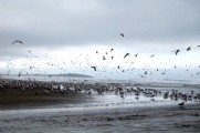
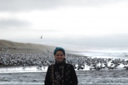
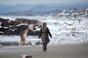
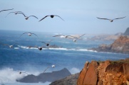
The Birds
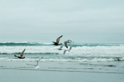
Our next stop was on a beach covered with birds. We found this funny given our previous session of remembering the eponymous movie from the little shop of Bodega, and headed there to experience the most uncanny feeling of being a bird-magnet—from the opposite pole—repelling a sluggish magma that was forming a circular depletion of birds around you as you walked slowly in. Increasing the speed would break the fragile equilibrium and have them fly away.
-
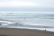 A river on the beach with birds all around.
 -
 Naturally, they fled away when we approached.
 -
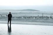 They would stay at a distance,
 -
 contributing a weird background of indistinct squealing and squawking.
 -
 Hitchcock atmosphere.
 -
 Although not admirable by themselves, they would become enchanting with the sea in background.


Various stops on the road
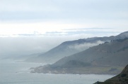
We had more stops on this day of the trip than any other, in part because we drove the longest distance. We tried to stop in villages and other inhabited areas, sometimes as small as a caravan where to buy coffee. It was a bit creepy, not that we felt at any moment in danger, but on this foggy days, desolated places with only the occasional pickup trucks passing by at very low speed, it was giving this sort of atmosphere they put at the beginning of American horror movies. We felt we got the gist of the idea pretty quickly and decided to dedicate our time to the natural scenery, which, in sharp contrast, was inexhaustible. Most notable stops were Arena cove and many points towards the Arena lighthouse, offering a romantic view—on this foggy day—of the last point of help and rescue on a treachery coast littered with sharp rocks emerging from the furious ocean.
-
 Picturesque signalisation.
 -
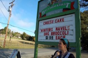 A stop to buy fruits in a creepy place.
 -
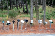 Mailboxes lining on the border of the road. Also creepy.
 -
 An old hotel in Gualala. Creepier and creepier.
 -
 The coast and its natural beauty was by orders of magnitude a better attraction
 -
 at any time of the day, under all weather conditions.
 -
 Even when some guy came to own it and put fences to keep you out.
 -
 The fog eating a mountain.
 -
 Arena point.
 -
 The lovely Arena lighthouse.
 -
 The sea and the land...
 -
 and their tumultuous meeting point.


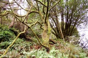
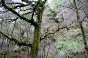
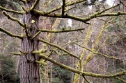
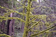
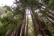
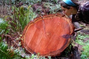
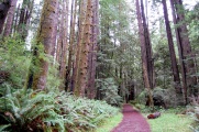
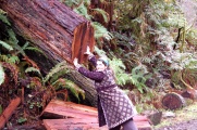
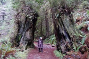
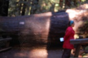
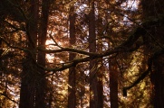
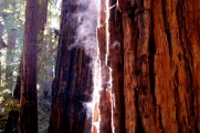
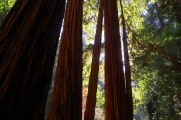
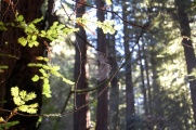
van Damme forest
It didn't rain but the fog was so thick that any moment felt like rain had just stopped. We went to visit a red trees forest which benefited much from this atmosphere. Whereas the coast was sad and nostalgic in the gray mist, the woods felt shiny and new. Beside, this was the most desolate point we found in California. No one was to be found nor heard from our two hours walk on a trail along the river. We got no hint either of people having recently visited the surroundings. The trees were true to their name and displayed a nice contrast with the green of the leaves glowing with wet light. Lace lichens also appeared, painting in gold these red trees. A panel warned of mountain lions (cougars) possibly attacking passers-by, providing for a welcomed excitement in the silent and lonely forest.
-
 A magical forest
 -
 where each tree has its own character
 -
 so pronounced, they seem to have a soul.
 -
 I could go on like this forever.
 -
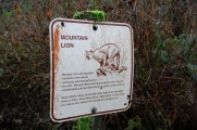 Cougars even inhabit this forest.
 -
 It's a tree of red wood.
 -
 Red like this.
 -
 Huge red woods.
 -
 Retaking hold of the whole place.
 -
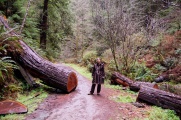 We would frequently walk through sawed giants fallen over the road.
 -
 An attempt to capture their height.
 -
 Elena dwarfed by the socks of two trees now gone.


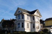
Mendocino
Our northernmost point was the village of Mendocino, famed for its scenic look of an old Californian village perched on the ocean and enclosed by red tree woods. It gives as much as that, even on a foggy day as the one on which we reached it on a late evening of winter. The Ford house, now the visitor centre, stands out for its intrinsic beauty and character. It is the house closest to the ocean and the prettiest of all.
-
 Mendecino.
 -
 A nice picturesque village
 -
 with yellow wood buildings proudly displaying the American flags.
 -
 These tanks scattered around contribute a lot to the atmosphere
 -
 giving a nostalgic touch
 -
 to surroundings otherwise much like the rest of the places around.
 -
 The Ford house, however, has something of its own
 -
 set apart from the village
 -
 the last comfy bastion facing the wild trees and the ocean.


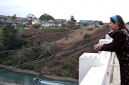
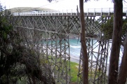
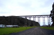
Albion river bridge
On our way to the motel, as the day was finishing, we crossed again a nice looking bridge, which already got our attention on the way up. We stopped to have a better view of it, and found it indeed to display either something unique, either something typical of its genre, we couldn't decide quite what. We later read on the Wikipedia it was the last remaining wood bridge on the hwy 1, soon to be dismantled as it no longer satisfies security standards. We are thus happy we took the time to admire this vestige soon to be disposed off, as it was proudly filling with all its legs the emptiness beneath. The pictures definitely do not reflect the grip it exerts on you, perched between a village and a forest, a rigid caterpillar of wood leaning over a river. We would not have even slowed down the car if it only looked like that.
-
 The bridge from the side
 -
 from the edge
 -
 from the top
 -
 from an angle
 -
 diving in the valley, to see it...
 -
 from below.


Fifth day
<googlemap lat="38.25975" lon="-122.947998" zoom="9" width="730" type="terrain"> 38.516878, -123.257679, Coast near fort Ross, 1 February (2012) 38.453883, -123.054074, Duncans Mills, 1 February (2012) 38.328208, -123.058269, Bodega Bay, 1 February (2012) 37.996430, -123.020977, Point Reyes lighthouse, 1 February (2012) 37.997412, -122.982207, elephant seal overlook, 1 February (2012) 38.046587, -122.989982, Point Reyes beach, 1 February (2012) 38.057446, -122.532229, Econo Lodge Novato, 1 February (2012) 38.107567, -122.570242, Novato, 1 February (2012) </googlemap>
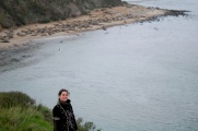
Coast near fort Ross
-
 We stopped so much on the north coast,
 -
 there is probably not one of its contours which we haven't seen from a distance.
 -
 Relaxing on a vantage point.
 -
 Conversing with the ocean.
 -
 Lots of birds again as we come back near Bodega bay.
 -
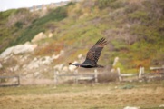 We've seen a lot of condors, much more majestic than the seagulls.
 -
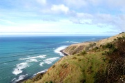 The unbounded beauty of the coast.
 -
 bringing in the same picture an infinity of variations. Already the colours open for endless possibilities.
 -
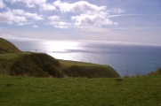
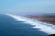
 This viewpoint was one of the most beautiful we found, with the country meeting its abrupt stopping point in the waters. It was grandiose. Sadly, the picture didn't capture that.
 -
 A funny encounter.
 -
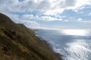
 Plenty of quiet space with view on the sea.
 -
 We mainly marvelled from above.
 -
 Beaches themselves were not so interesting, and are reputedly dangerous.
 -
 We had to stop somewhere and bring the car with us, otherwise we'd happily have walked all the way through.
 -
 Back on the hwy 1.


Duncans Mills
We made a small detour inland to widen our perspective from that of the coast only (the hwy 1 on the north of San Francisco literally border the coast for pretty much all of the time). We took a road which brought us to beautiful sceneries. Fearing we'd go too far, captured by this stream of awesomeness, we decided to stop at the next village and turn back. This happened to be Duncans Mills, not so dull as Davenport (see above) and much smaller than Mendecino but offering a bit of both (authenticity and some cultural heritage).
-
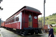 One of the old trains stationed there.
 -
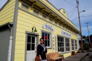 We had lunch in this cute little place.
 -
 One of the views on the way, typical from this area.


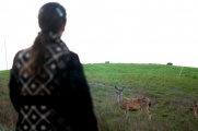
Point Reyes lighthouse and elephant seal overlook
Point Reyes was on our agenda since the beginning, but found its place on the last full day of the trip. It is a pity as the place is so outstanding, we would have explored it more thoroughly with more time. The lagoons area seemed particularly breathtaking. On the way to the lighthouse, there is a view of the impressive Point Reyes beach, on which one could track trains of waves forming and clashing on the shore in slow and inexorable successions. We would go to this beach for one of the most amazing sunset of the trip a bit later. In the meantime, we paid a short visit to the elephant seal overlook. It was a different one of its kind—by then we had seen dozains of elephant seal colonies—for the peculiar concert of sounds we heard only at this place. Not only were there the seals trumpeting, with a force and frequency never found before, but also were intertwined strange honking and clicking and quacking of all genrse, from the same or other animals, we couldn't tell.
-
 On our way to Point Reyes, which is on the other side of this incursion of the ocean in the United State (Tomales Bay).
 -
 Despite being so close to San Francisco, Point Reyes turned out to be quite authentic.
 -
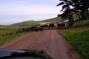 Here a modern cow-boy.
 -
 The coast looks as wild as any.
 -
 Although a bit gentler.
 -
 The Point Reyes beach looks never ending.
 -
 Maybe it is.
 -
 I thought only South England had those.
 -
 Point Reyes lighthouse.
 -
 Wildlife on the lookout.
 -
 Sea lions.
 -
 We had seen plenty before, but it was a cacophony of weird sounds here.


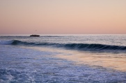
Point Reyes beach
This was the last sunset, and one of the most remarkable, since with the blazing colours of the sky, clashing with the blue palette of ashes as of a furnace blown out by the sea, we found there the most violent sea erecting walls of water which let themselves fall freely and explode in tonitruous collisions back on the ground, projecting clouds of ocean in your face tens of meters away, and sending the sea licking your feet and make you run with bigger waves that would splash you till the torso if not escaping them. Despite all this animation, each picture seemed like a painting.
-
 We arrived just in time for the sunset.
 -
 In the clouds, as all of them before.
 -
 but with its unique display of light and tricks with the sand, also as all of them before.
 -
 Most impressive here was the intensity of the waves
 -
 and the desolation of the place. Only us...
 -
 and the sea.


Sixth and last day
<googlemap lat="37.847206" lon="-122.475586" zoom="11" width="730" type="terrain"> 37.899551, -122.577026, Muir woods, 2 February (2012) 37.821135, -122.529662, Point Bonita, 2 February (2012) 37.82715, -122.49912, a viewpoint on the Golden gate, 2 February (2012) 37.827612, -122.48197, a viewpoint on the Golden gate, 2 February (2012) 37.794205, -122.483286, Baker beach, 2 February (2012) 37.802205, -122.418707, Lombard street, 2 February (2012) </googlemap>
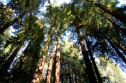
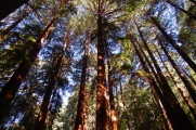
Muir woods
On our last day, with the airport to reach by 17:30, we had planned to finish with the best of San Francisco, which is the Golden Gate bridge. We made a short stop at the nearby Muir woods, a preserved sample of what was previously covering all the Californian coast: the gigantic red trees. We already knew them from our trip to Mendecino, but the Muir woods had more impressive specimens gathered together in a higher density. However, the presence of many tourists and a rigid trail to which you are confined made the experience much less genuine and inspiring.
-
 The red trees (redwood) of Muir woods.
 -
 Our same unsuccessful attempt to capture a sense of their height.
 -
 The Kent tree (a Douglas fir, not a redwood), is a symbol of the park named in honour of its protector. It fell down in 2003.
 -
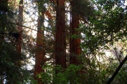 The redwood species contains the largest and tallest trees in the world.
 -
 They can live up to thousand years.
 -
 Redwood and yellow lichen.
 -
 Their humidity is such that a bit of sun makes these spongeous giants sweat profusely.
 -
 A prehistoric look.
 -
 Maybe a centenary spider.


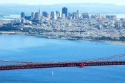
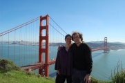
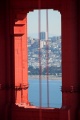
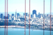
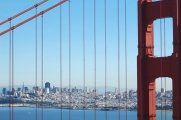
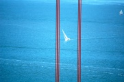
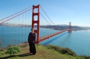
Views of the Golden Gate bridge
The best views of the bridge are from the park opposing it, putting San Francisco and Alcatraz in background. We stopped at half a dozain locations, each providing its particular angle and distance on this modern wonder. The best location is the closest one, though, where the bridge is so immense, it appears to be at an handful distance. You feel like jumping on it!
-
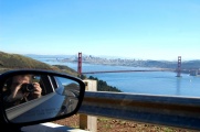 Back to San Francisco,
 -
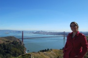 and its landmark of America.
 -
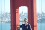 The Golden Gate bridge.
 -
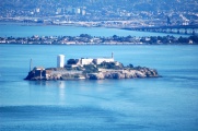 Acatraz.
 -
 San Francisco, in the cradle of the bridge.
 -
 There are so many viewpoints,
 -
 and so many ways to play with them.
 -
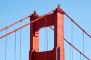 The bridge's colour is known as international orange, something that resembles very much vermilion.
 -
 The official colour of San Francisco is probably powder blue.
 -
 Guarding the city.
 -
 Sailing the bay.
 -
 Last unforgettable sighting before crossing.


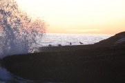
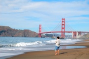
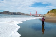
Baker beach
Another complementary view of the Golden Gate bridge, from the beach which keeps San Francisco apart from the ocean. With the views from the Presidio, which we had on our first day in San Francisco with conference colleagues, and those from Alcatraz, where the bridge appears straight, this complete our collection of viewpoints of the most famous bridge in the World and possibly the most beautiful one.
-
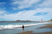 This unique and wonderful beach was surprisingly quiet.
 -
 It was quite romantic that in such a scenic location, people would still casually go about their business.
 -
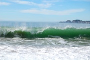 Even if beautiful, waves were quite tamed there, surely on account of a calm day,
 -
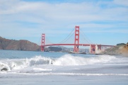 but with the bridge in background, each one of them was posing for a picture.
 -
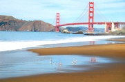 These birds would exhibit an adorable dance back and forth in the wake of the waves.
 -
 We ended out performing the same sort of ritual.


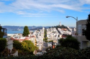
Last drive in San Francisco
Before the airport, we had time to visit a very nice seafood restaurant (El Sotto del Mare), where we could taste for the last time the delicious oysters from Point Reyes and have a last drive in the city, which is fun with an automatic car on roads that are very steep, alternatively up and down. We even drove through the zig-zag of Lombard street. Our last stop ever was at the mission of San Francisco, in memory of that in Carmel which had impressed and pleased us so much.
-
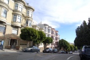 The familiar streets of San Francisco, now from the car's point of view.
 -
 Lombard street.
 -
 A one-block section with eight tight hairpin turns.
 -
 Local sea food before flying home.
 -
 after a last stop at Californian missions.


